![]()
Northern BC weather is looking a little bit cooler in the forecast according to Environment Canada.
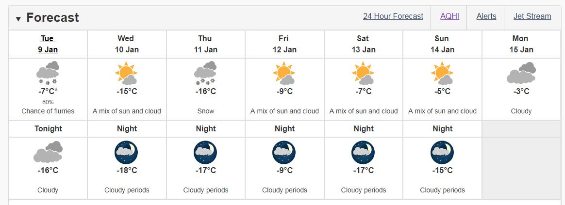
Temperatures are expected to drop nearly 10 degrees below the normal average with highs of -15 on Wednesday and -16 on Thursday, plus windchill.
Meteorologist Trevor Smith says this is because of the upcoming arctic front.
“North winds are going to be picking up to about 30 kilometres per hour and, more importantly, the temperature will be falling to -11 degrees in the afternoon. Of course, with the windchill, it’ll feel much colder than that.”
Stretch from Prince George, through Vanderhoof, and into the Bulkley Valley and Lakes District, two to five centimetres of snow is being predicted.
Looking ahead to the weekend though, Smith says the snow should start to deteriorate.
“Drying by the weekend for sure, highs around minus-six, lows of -15, and we’ll go back to a little bit of snow probably for the early part of next week, but it’s a little bit early to say at this point.”
He emphasizes however the snowfall in the region may not be as bad as the what Southern BC will see in the days ahead as snowfall warnings are in effect.
Something going on in the Bulkley Valley Lakes District you think people should know about?
Send us a news tip by emailing [email protected].