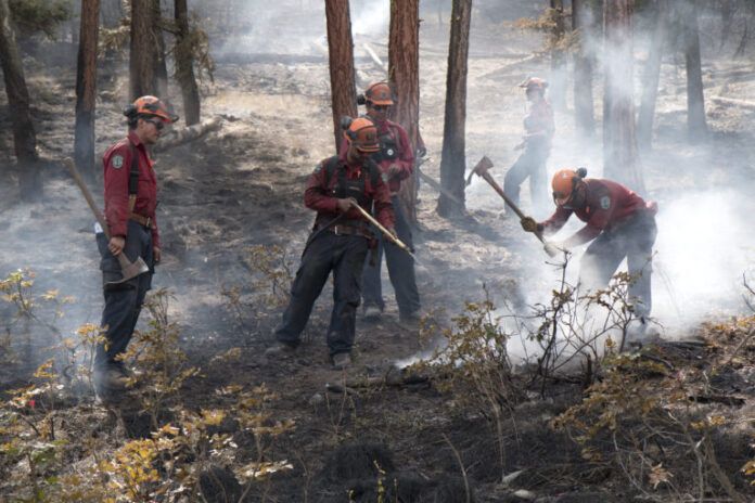
The second-largest wildfire in BC’s history is nearly 311-thousand hectares.
Due to a strong wind event yesterday (Tuesday), the Donnie Creek wildfire southeast of Fort Nelson saw substantial growth.
Fire Information Officer, Julia Caranci told Vista Radio while crews will be dealing with less wind, the upcoming weather forecast is set to bring more challenges.
“The good news is that we will have significantly less wind, so very light winds over the next several days but on the other hand, a warming and drying trend to above seasonal conditions at least until this weekend when we are not exactly sure whether there will be a significant change in the weather or not.”
With Mother Nature not cooperating at the moment, fire personnel are once again being forced to change their plan of attack.
“Our objective moving forward is that we are going to use direct parallel and indirect strategies to minimize fire growth on the south and west flanks of the fire so that is one of our objectives. We are using a modified response on the north and east sides of the fire with structure protection as the primary mitigation strategy.”
“Advanced forward planning is ongoing to identify potential future impacts to structures and industries based on our growth projections.”
Caranci adds crews are also keeping a close eye on the Holman Creek wildfire, which is also exhibiting some extreme behaviour.
She says they are anticipating Holman Creek is expected to merge with the Donnie Creek blaze sometime today (Wednesday).
“It exhibited extreme fire behaviour due to those strong winds and pushed it to the northeast. So, we are anticipating the very real possibility that fire and the Donnie Creek could join together.”
Evacuation orders and alerts in relation to the Donnie Creek Wildfire remain in place by the Peace River Regional District.
The Donnie Creek Evacuation Order includes the following areas:
- The area North of Grewatsch Creek on PDR 222,
- The area North of km 44 on Tommy Lakes Road,
- To the junction of Horse Range Creek and Sikanni Chief River,
- Northeast along Sikanni Chief River to the Peace River Regional District,
- The area North of km 20 on PDR 204 (Beatton Airport Road), and
- Extending North to the border with the Northern Rockies Regional Municipality.
The Alert applies to the following:
- 1km East of Highway 97 between km 225 and km 273,
- Due East to a point where it insects with West Milligan Creek,
- Due North to a point of intersection with Cautley Creek,
- Northwest to the Peace River Regional District,
- West following the Peace River Regional District boundary to Kahntah River,
- South following Donnie Creek/Tommy Lakes Wildfire Evacuation Order #5 to Buckinghorse River, and
- Southwest to 1km East of Highway 97.
In addition, an Evacuation Alert is also in place regarding the Klua Lakes blaze which is 31,228 hectares in size.
Evacuation Alert #1 applies to:
Something going on in the Bulkley Valley Lakes District you think people should know about?
Send us a news tip by emailing [email protected].
- South along the Sikanni Chief River from the Peace River Regional District boundary,
- To the junction of the Sikanni Chief River and the Horse Range Creek, and
- Due North to the Peace River Regional District Boundary.


