


Updated 7:58 p.m., July 11th, 2023
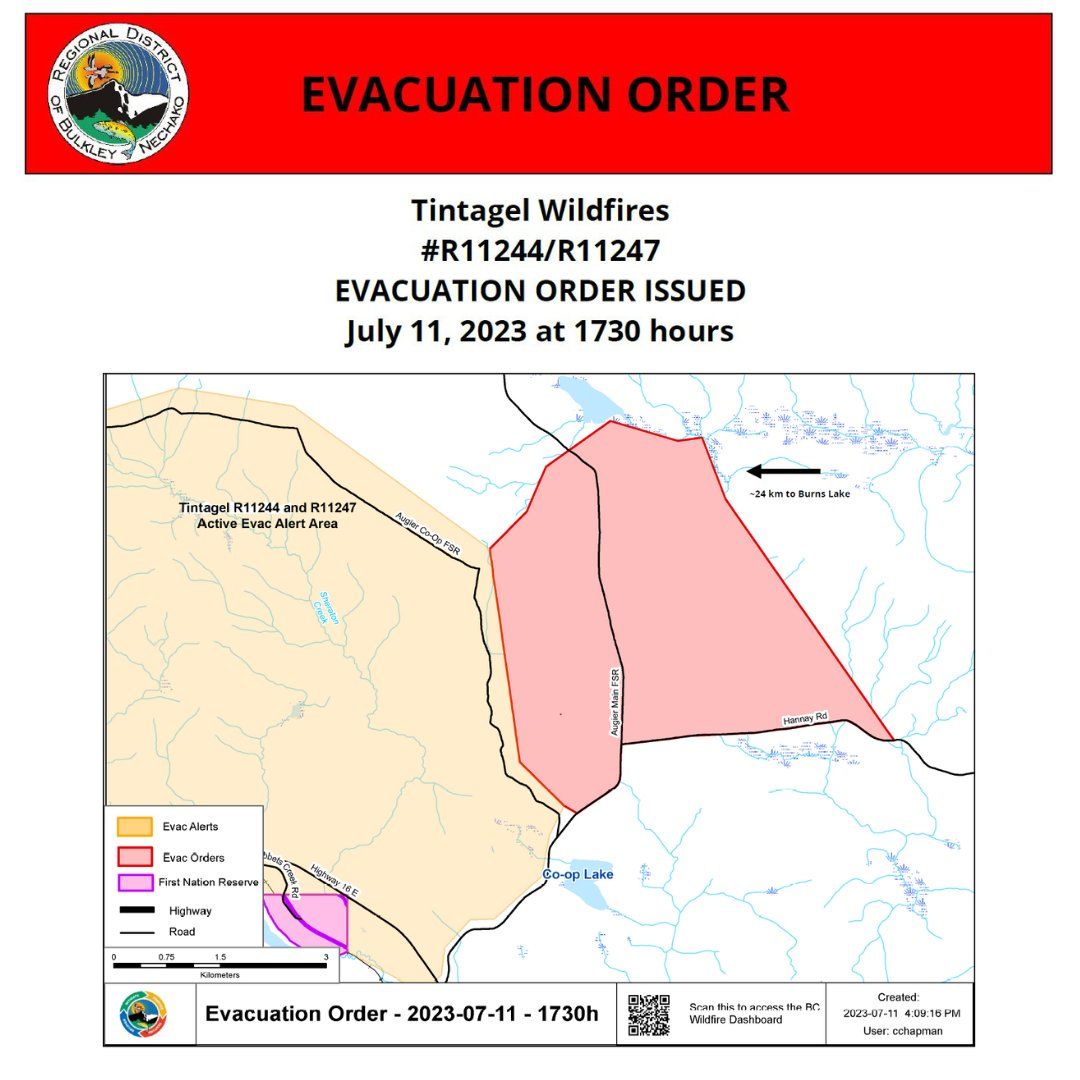
A new evacuation alert has been issued for properties on Augier Main Forest Service Road and Hannay Road north of Co-Op Lake.
The order came into effect at 5:30 p.m. tonight, and residents are being asked to register at the Burns Lake Multiplex Reception Centre.
Updated: 6:15 p.m., July 10th, 2023
The Regional District has released an amendment to the evacuation alert and expanded the evacuation order for the Tintagel Wildfires.
All lands and properties accessed by Gowan, Wiebe, and Boer Mountain Roads south of the Kager Lake Campsite are no longer under evacuation alert.
The evacuation order was expanded to encompass part of the western end of the evacuation alert.
Original Story:
The Regional District of Bulkley-Nechako has issued an evacuation order for Kager Lake Campsite and Trails, and Boer Mountain Trail system.
Also issued is an expansion of the evacuation alert area issued earlier today (Saturday) for all dwellings and property east of Burns Lake accessed by Gowan, Wiebe, or Boer Mountain Roads.
Both are responses to the Tintagel and Sheraton Creek wildfires burning east of Burns Lake.
They were discovered Friday evening.
Sheraton has burned 275 hectares and Tintagel 350 hectares as of 6:37 a.m. July 10th.
Both are fires of note according to the BC Wildfire Service, and listed as out of control.
Lightning is suspected to have caused both fires.
Something going on in the Bulkley Valley Lakes District you think people should know about?
Send us a news tip by emailing [email protected].